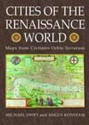
CITIES OF THE RENAISSANCE WORLD. MAPS FROM CIVITATES ORBIS TERRARUM
Autor/es
- EAN: 9781906347109
- ISBN: 978-1-906347-10-9
- Editorial: COMPENDIUM PUBLISHING LTD
- Año de la edición: 2008
- Encuadernación: Cartoné
- Medidas: 30 X 42 cm.
- Páginas: 224
- Materias:
urbanismo
historia del urbanismo
ciudades y países
cartografía, mapas
Stock en Librería. Envío en 24/48 horas
pvp 40,00 €
The first volume of the Civitates Orbis Terrarum was published in Cologne in 1572. This great city atlas, edited by Georg Braun and largely engraved by Franz Hogenberg, eventually contained 546 prospects, bird's eye views and maps of cities from all over the world. Braun, a cleric who lived in Cologne, was assisted in his project by Abraham Ortelius, whose Theatrum Orbis Terrarum of 1570 was the first true atlas. The Civitates, indeed, was intended as a companion for the Theatrum, but was designed to be more popular in approach. Franz Hogenberg had engraved most of the plates for Ortelius's Theatrum, and may have been responsible for originating Civitates. Many different artists and cartographers worked on it, the most significant of whom was Antwerp artist Georg (Joris) Hoefnagel - and after his death his son Jakob. He not only contributed most of the original material for the Spanish and Italian towns but also reworked and modified those of other contributors. Braun added to the maps figures in local dress. His motives for adding figures to the views, however, went further: as stated in his introduction to book 1, he believed, perhaps optimistically, that his plans would not in consequence be scrutinized for military secrets by the Turks, as their religion forbade them from looking on representations of the human form. The plans, each accompanied by Braun's printed account of the town's history, situation and commerce, form an armchair traveler's compendium. This book chooses 50 of the most interesting maps from the Civitates - from Cuzco in the Americas to Calcutta in the Indies - and interprets them, explaining what can be seen in the 16th century map, how that differs from today's cities, and analyses the other information - from costumes to heraldry - that each of these maps show.

