
MAPPING SPACES. NETWORKS OF KNOWLEDGE IN 17TH CENTURY LANDSCAPE PAINTING
Autor/es
- EAN: 9783777422305
- ISBN: 978-3-7774-2230-5
- Editorial: JOHN WILEY & SONS, INC.
- Año de la edición: 2014
- Encuadernación: Cartoné
- Páginas: 500
- Materias:
urbanismo
cartografía, mapas
catálogos de exposición
Sin stock. Envío en 15/30 días
pvp 78,69 €
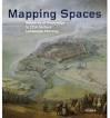
Seventeenth-century Europe saw a fruitful creative exchange between the arts and contemporaneous scientific thought. "Mapping Spaces" traces the multifaceted dimensions of this exchange with contributions from more than forty leading scholars who, together, reflect on the influence of science and technology on the arts through the specific study of the process of mapping in Dutch landscape paintings of the mid-seventeenth century. The dialogue between the arts and sciences, the contributors find, extends back well beyond the new media and digital satellite imagery of modern times. Many Dutch painters of the period are believed to have employed systems of remote sensing for their paintings. For his well-known historical battle scenes, for instance, Pieter Snayers would have required an understanding of both ballistics and geography. Bringing these and many other insights together with more than 350 large-format illustrations, "Mapping Spaces" presents readers with past exchanges of knowledge that surprisingly anticipate the techniques of mapping used today.


Otros libros del mismo autor